Snapshots of History by Mike Avitt
PROTECTED CONTENT
If you’re a current subscriber, log in below. If you would like to subscribe, please click the subscribe tab above.
Username and Password Help
Please enter your email and we will send you a password reset link.
This week’s picture comes from the A. T. Andreas Illustrated Historical Atlas of 1875. This is the earliest map I’ve ever seen of Ringgold County; no railroads yet. I know you can’t see the details, but someday this map will be used by other historians and I’ll give them a head start with this article.
A cross appears on the southeast edge of Mount Ayr indicating Rose Hill Cemetery. So, the cemetery was established a little earlier than I thought. The name Rose Hill Cemetery began being used in the early 1880s. The graveyard was called the “south cemetery” in its infancy. Raymond Banner’s book has Charles and Susanna Arnot buried here, both passing away September 18, 1872. This makes me think the bodies were moved here after the cemetery was established. This was not uncommon.
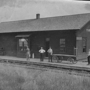
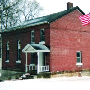
The Tingley Post Office is located in the northeast corner of section 2, Tingley Township. This was Edgar Sheldon’s house and Edgar was the father of Frank Sheldon, the future president of the Mount Ayr Bank and the developer of Mount Ayr’s Sheldon Heights in 1913.
The Goshen Post Office is located neat the center of section 1, Grant Township with Michael Stahl as postmaster. The house of Henry Todd, the Bethel Church and School are pictured a little south of the Stahl residence. The house of William DeLashmutt is to the north. Mr. DeLashmutt was deaf but such were his communication skills, he became Mount Ayr Postmaster in 1898. The town of Goshen didn’t materialize until 1881.
The grist mill in section 22, Lincoln Township, was run by George (son) or Jacob (father) Wyant. The Marena Post Office was active at this time, also.
The community of Marshall is shown in the north central part of section 5, Rice Township. Thomas Sherrill’s house is nearby. Mr. Sherrill contributed to the beginning of both Knowlton and Benton. Marshalltown Cemetery is what is left of the former hamlet.
I see a rural church located about halfway between present-day Maloy and Benton; the northwest corner of section 23, Benton Twp. I have no info on this church.
The original location of “old” Redding is shown in section 14, Clinton Twp. The Redding Post Office is located two miles north. “Old” Redding first appears in the Ringgold Record newspaper in 1875.
Newport is visible in Middle Fork Twp., but this was a proposed town that never developed. Ingart Grove Post Office is next to Newport.
Sweet Home Cemetery at Lesanville was established by 1875 and is seen in section 2, Mount Ayr (later, Poe) Township. The Lesan and Terwilliger families lived in this area.
High Point Methodist Episcopal Church can be seen in section 12, Liberty Twp. and was one year old when this map was made. This church was one mile west of the Blackmore community.
Union Hill Post Office was located in the south central part of section 15, Union Twp. This post office was discontinued in 1882 when the Wirt (Ellston) Post Office was opened. Wirt’s name was changed to Ellston on January 1, 1896.
The Bever-Grimes Cemetery appears in section 12, Jefferson Twp. This was the location of Ringgold County’s first church building erected circa 1858. In section 13 we see the town of Eugene with its United Presbyterian Church. Eugene’s cemetery does not yet appear.
The Ringgold County Fairgrounds appear where they are today, but the association struggled badly in the years 1905 to 1925 and this land ended up in the hands of two different owners at that time. The fair endured fierce competition from Chatauqua, Farmers Institutes, street fairs, old timers reunions and the like. But fate was on the side of the Ringgold County Fair Association and they are back on their original land today.